In-Situ Observations at Station 46012
Provided reliable near real-time coastal observations supporting forecasting, navigation safety, ecosystem monitoring, and climate research.
Capabilities
Uncrewed Maritime Systems Operations • Data Integrity & Quality Control • NOAA Systems Integration • Sanctuary Compliance
Mission Context
Accurate, near real-time ocean and weather observations are essential to protecting life and property, enabling operational forecasting, supporting marine safety, and advancing scientific understanding of coastal systems. Within the Monterey Bay National Marine Sanctuary, NOAA depends on trusted in-situ observations to serve a broad community of users who rely on timely environmental intelligence.
Objective
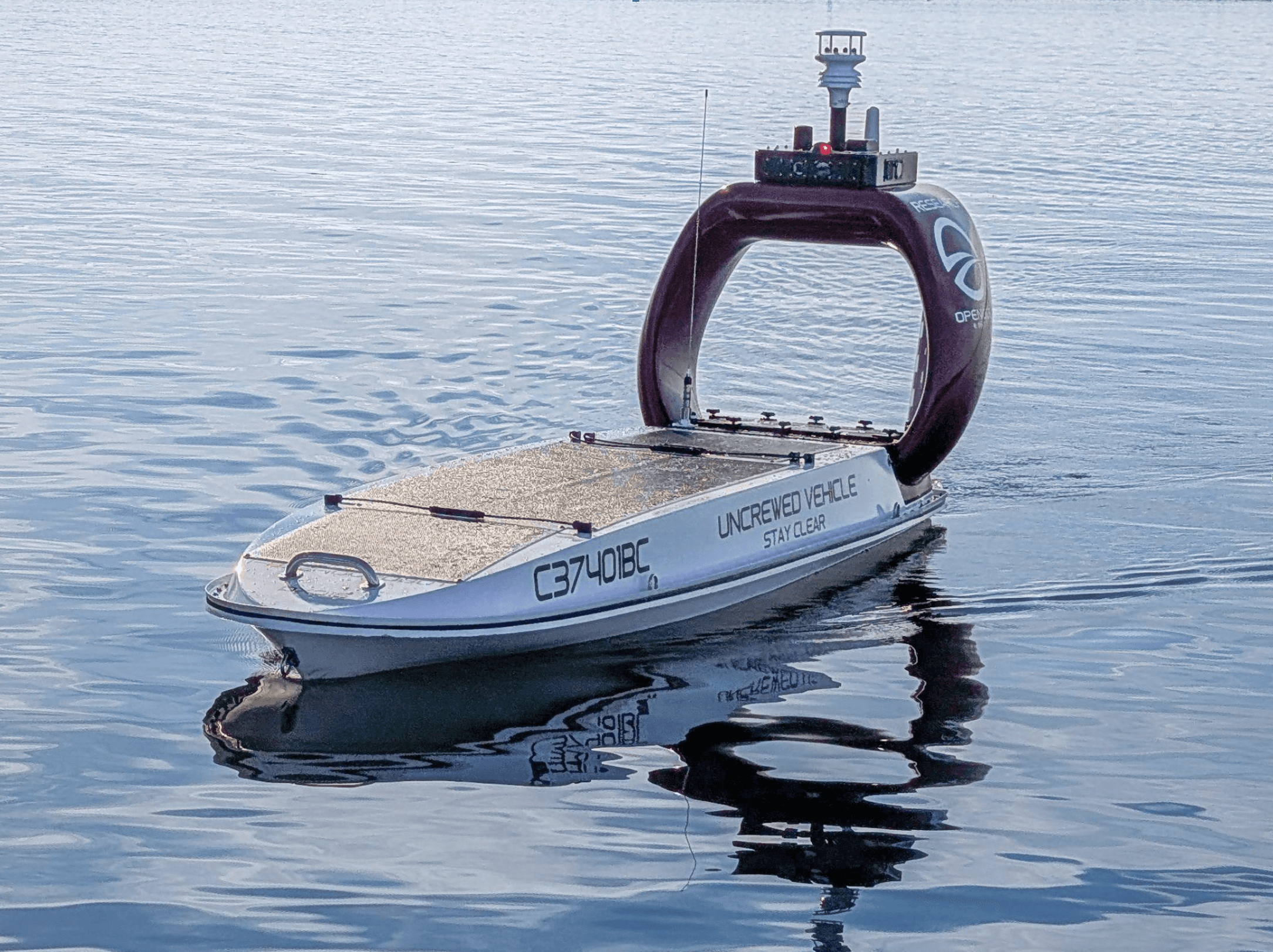
Provide sustained, near real-time in-situ oceanographic and meteorological observations at Station 46012 to support NOAA’s operational needs, including delivery of hourly observations suitable for NOAA quality control and dissemination through NOAA systems.
Hourly uncrewed maritime systems (UMS) data are publicly available via NOAA’s National Data Buoy Center (Station 46012) data portal: https://www.ndbc.noaa.gov/station_page.php?station=46012.
@Orchard Solution
As prime contractor, @Orchard executes an end-to-end observing mission that integrates UMS operations, disciplined data integrity controls, and NOAA-aligned delivery workflows. Our work supplements traditional observing infrastructure by sustaining high-value observations through uncrewed systems that can operate in dynamic coastal conditions while maintaining compliance with sanctuary requirements. This includes persistent station-keeping at the observation location and rapid response to data-quality or operational flags to protect continuity of observations. From sensor integration and quality assurance through near real-time data delivery, @Orchard ensures observations can be received, quality controlled, and distributed through NOAA channels for operational use and public access.
Impact
This ongoing effort strengthens NOAA’s ability to maintain continuity of critical in-situ observations in a high-priority coastal region, helping ensure the public, researchers, and operational users have access to trusted information about ocean and weather conditions when they matter most. By enabling near real-time observations to flow through NOAA’s established dissemination pathways, the project reinforces the resilience of the national observing enterprise while demonstrating how modern uncrewed approaches can responsibly augment traditional infrastructure in environmentally sensitive waters. In doing so, @Orchard supports NOAA’s broader mission — delivering trusted environmental intelligence that improves readiness, decision-making, and responsible stewardship at scale. The same approach generalizes to other missions requiring persistent uncrewed operations, quality-controlled data delivery, and disciplined program execution in remote or constrained environments.
Prepared by @Orchard LLC. Approved for public release by NOAA NDBC, March 27, 2026.


